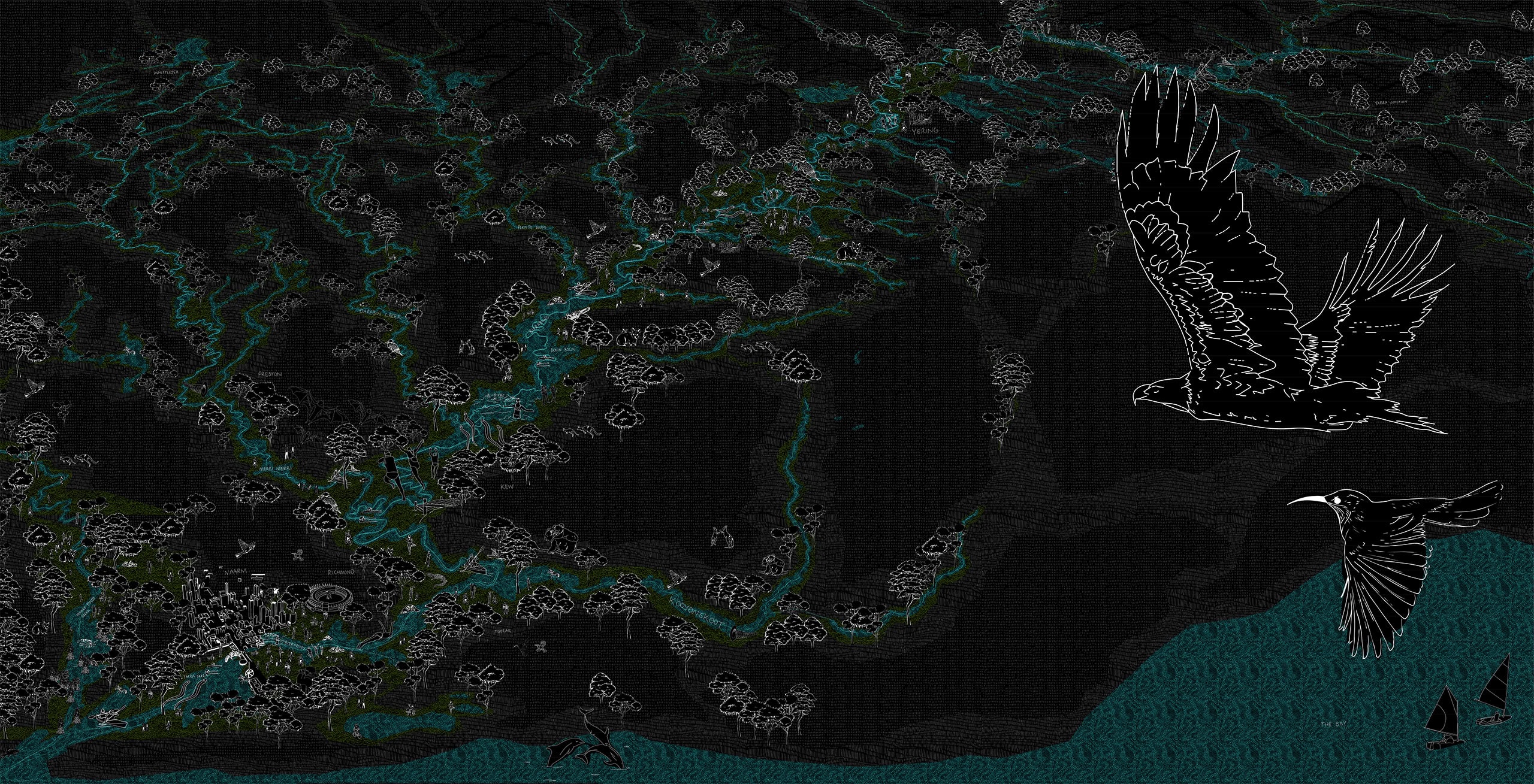
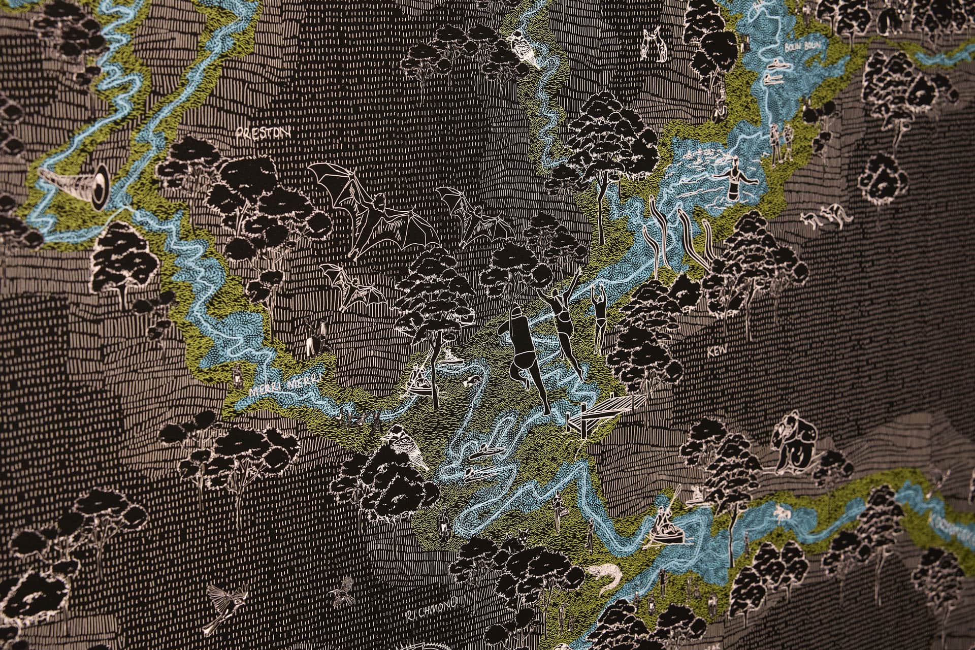
THE BIRRARUNG CATCHMENT by McGregor Coxall
This animated projection maps the past, present and potential future of the catchment, highlighting the evolution of the Birrarung’s lands, health, waterways, and its relationship to people
The projection explores the historic impact of climate, population, urbanisation, pollution, deforestation and land management practices on the Birrarung’s watercourse and its lands.
In the context of the current climate and biodiversity crisis, as well as Melbourne’s anticipated population growth, the projection looks forward in time to simulate a re-examination of the land use, ownership and management practices needed to establish the Great Birrarung Parkland.
Project Statement
All land within the Birrarung’s catchment impacts the river itself. As such, this project examines the river beyond its water course – as one living, integrated natural entity – through the perspective of past, present and future.
As a vast living entity, the Birrarung existed freely and unrestrained for over one hundred million years, shaping and being shaped by the lands.
There is an intrinsic connection between the Birrarung and its Traditional Custodians, which has developed over a period of deep time. This work examines how colonisation has and continues to cause irrevocable damage to the Birrarung – through alteration and coercion – to the river’s health, its lands and its people.
Looking forward, this project offers a future where the Birrarung is a connected and expansive vital waterway, enabled by First Nations’ cultural land management practices. Mapping incremental and catchment-scale change, this project envisions that by 2070 Melbourne could feasibly coexist with a thriving Great Birrarung Parkland.
The Birrarung catchment area includes 4078 square kilometres of land and is home to more than two million people – about one third of the population of Victoria. The river is 424 kilometres long and starts at Mt Baw Baw in the Yarra Ranges National Park, flowing downstream to the mouth of the river at Port Philip Bay. It is a significant waterway, fed by twenty-four tributaries and providing approximately 70% of Melbourne’s drinking water. The Birrarung is the source of life for diverse ecosystems and provides habitat for fish, reptiles, mammals and more than 190 species of birds.
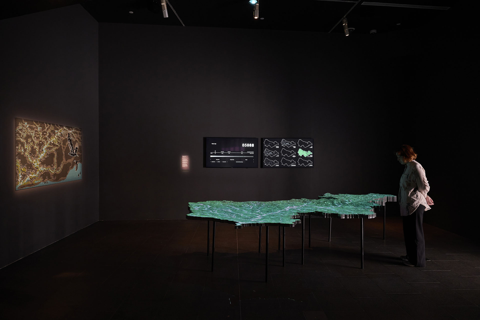
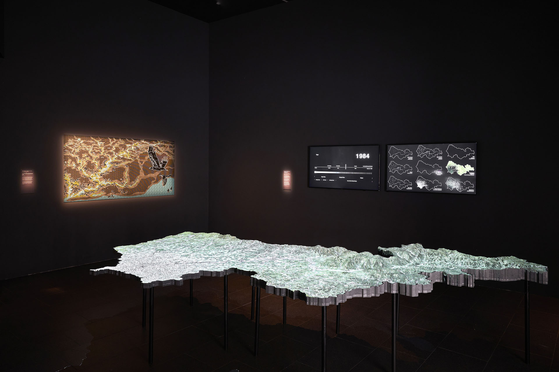
The vast scale and complexity of the Birrarung, its topography, river network and ecology, can be demystified using the expertise and tools of landscape architecture. This scale model of the Birrarung catchment combines topographic modelling, mapping and data analysis to visualise the social, economic and environmental factors that have shaped the Birrarung and how we live with it. Tracing the layers of the past and speculating into the future, the data presented here culminates with a vision for the Greater Birrarung Parkland, advocated for by the Birrarung Council, Traditional Custodians and others, of a connected parkland providing a continuous, publicly accessible landscape and habitat that runs the entire length of the Birrarung. This parkland could be fully implemented by 2070.
The Great Birrarung Parkland 2070
Visualising the Great Birrarung Parkland in 2070, the city here is designed to allow the Birrarung ample space to flow and flood naturally. Traditional Custodians lead its parkland management and it’s clear waters support thriving native flora and fauna.
The lands and accessible banks along the entire length of the river invite people to spend time with the Birrarung and swim in its pristine waters – from its source to the sea.
About McGregor Coxall
McGregor Coxall is an interdisciplinary studio that designs resilient, prosperous places. Working with First Nations Peoples, communities and embracing leading digital technologies, they design for complex urban and environmental challenges.
Viewing cities and towns as living systems interconnected with nature, McGregor Coxall creates urban environments that are resilient to the challenges of the climate crisis and rapid urbanisation. The studio exercises the nuanced processes of landscape and urban design to integrate people, place and the environment in each project.